 vesseltracker.com
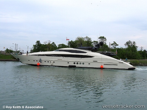
Vessel LADY M IMO: 1012012, MMSI: 319297000 Yacht
UTC, 43.87768, 8.02412, course: 138, speed: 0
UTC, 43.87769, 8.02413, course: 138, speed: 0
2026-02-21 11:57:51 UTC, 43.87769, 8.02412, course: 138, speed: 0.1
Live AIS position:
UTC. Near IMPERIA),
updated 2026-02-21 11:57:51 UTC.
Find the position of the vessel LADY M on the map. The latter are known coordinates and path.
marine traffic ship tracker show on live map
The current position of vessel LADY M is 43.87769 lat / 8.02412 lng. Updated: 2026-02-21 11:57:51 UTCCurrently sailing under the flag of Cayman Islands
LADY M built in 2013 year
Deadweight:
0 tDetails:
Last coordinates of the vessel:
UTC, 43.87770, 8.02407, course: 138, speed: 0UTC, 43.87768, 8.02412, course: 138, speed: 0
UTC, 43.87769, 8.02413, course: 138, speed: 0
2026-02-21 11:57:51 UTC, 43.87769, 8.02412, course: 138, speed: 0.1